The Road to Plum Creek, 1836–1845
Micro-History as Global Structure
A Digital History Exhibition
“Invasion is a structure, not an event.” — Patrick Wolfe, 2006
Remembering Colonial Texas
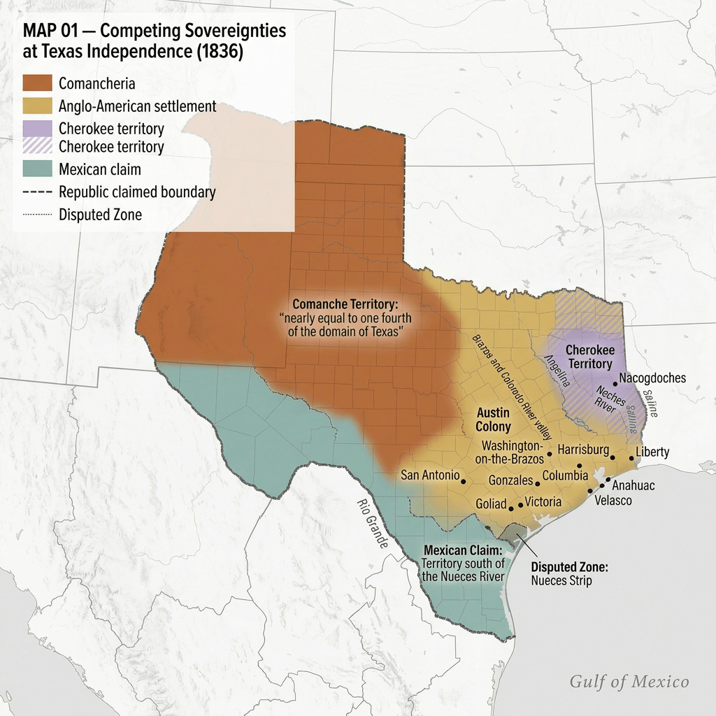
In 1836, a line was drawn on a map of Texas — not on empty land, but across Comancheria, the sovereign domain the Comanche nation had governed for over a century. The men who drew that line claimed authority they did not yet possess, in the name of liberty. What that promise meant — and who it excluded — is what this exhibition examines.
The story “Texas” has long told about itself moves from the Alamo to the frontier, from independence to civilization. This exhibition argues that story is an ideological construction — a myth manufactured to make a systematic process of dispossession appear natural, inevitable, and just.
That process had a name: settler colonialism.
The Framework — 60 Seconds
Historian Patrick Wolfe made a distinction that organizes this entire exhibition:
Settler colonialism is different from other forms of colonial rule. It doesn’t primarily want your labor. It wants your land — permanently. And because settlers come to stay, the Indigenous peoples already there become, in the logic of the system, an obstacle to be removed.
Wolfe called this the logic of elimination. It operates not through violence alone, but through an interlocking system of laws, land grants, military campaigns, immigration policies, and diplomatic instruments — all serving the same territorial end.
Most importantly: this logic is a structure, not a series of events. It doesn’t begin and end with a battle. It persists through property arrangements, legal institutions, and cultural stories — long after the frontier “closes.” The events of 1836–1845 are the foundation of a geopolitical space — the state of Texas — that still exists today.
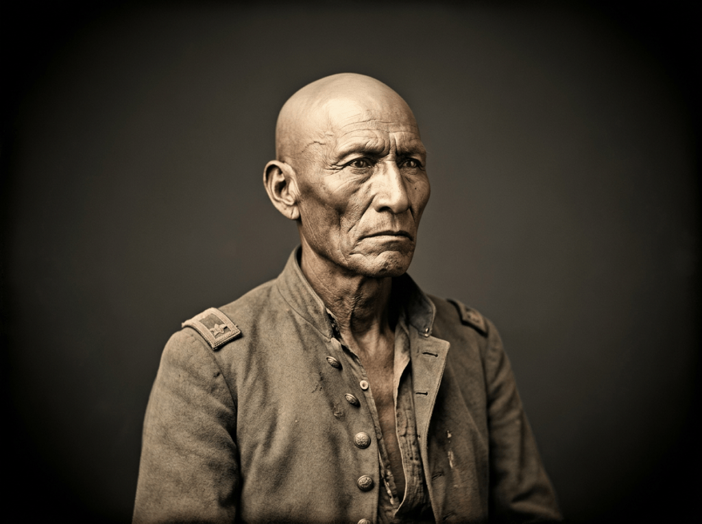
Race, in Wolfe’s framework, is made in the targeting — not prior to it. The Comanche were not eliminated because they were savage. They were declared savage because they occupied land the Republic required.
Glossary
Too much jargon? Check out our Glossary page for the following terms: settler colonialism · logic of elimination · racial geography · rabble-state convergence·
The Structure Built, 1836–1843
The Republic of Texas built its apparatus of dispossession through four simultaneous mechanisms:
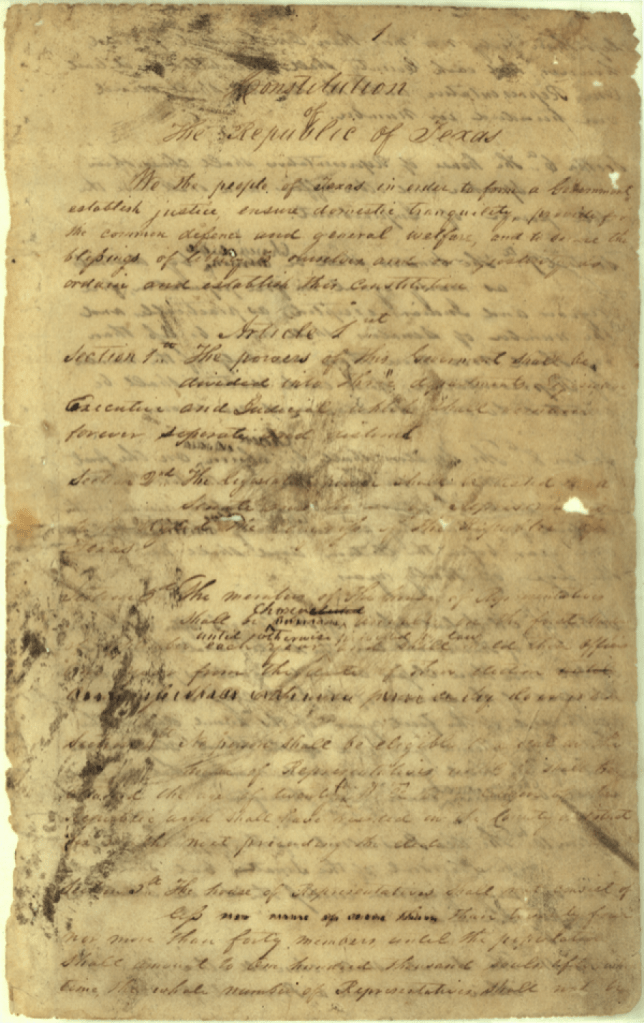
1. The Legal Order The 1836 Texas Constitution granted every white male head of family 4,605 acres — while explicitly stating that “Negroes and Indians were expressly excepted.” The 1837 Act to Quiet Land Titles validated all empresario grants without acknowledging a single Indigenous territorial claim. Comanche sovereignty was not defeated by these laws. It was classified out of existence before the first campaign began.
📄 [Document: An Act to Quiet Forever the Land Titles, 1837] 📄 [Document: Public Land System of Texas — McKitrick, pp. 36–46]
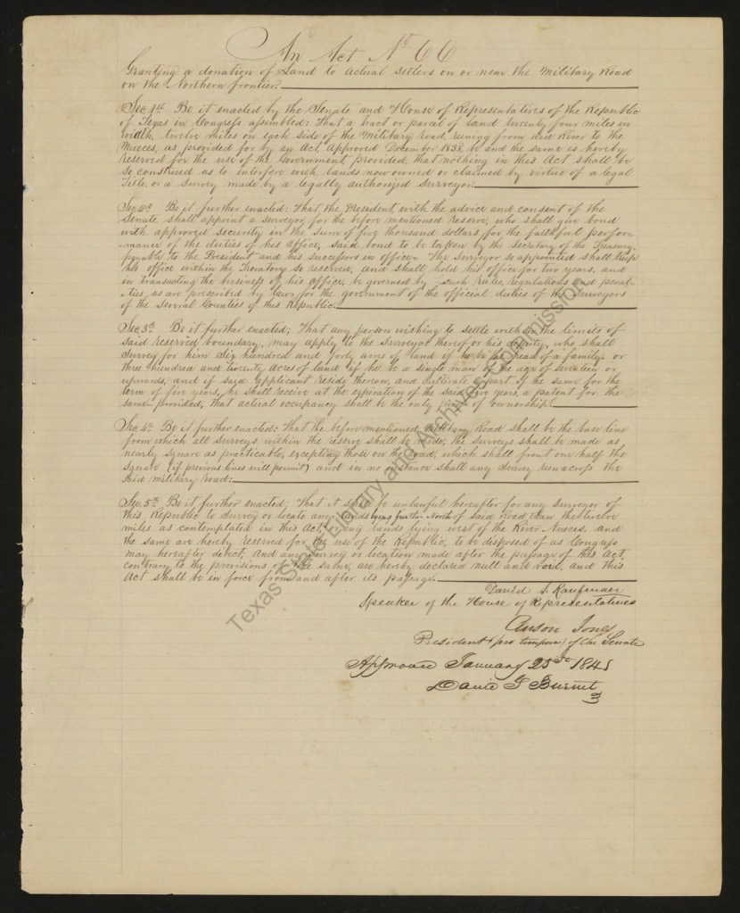
2. Soldiers Paid in Land The December 1838 Frontier Protection Act created a frontier army on a single revealing principle: soldiers received 160 acres for a three-year enlistment. By 1888, Texas had granted over five million acres as military bounty grants. The soldier who fought for the frontier had a financial stake in how far it moved — and when his service ended, he stayed on it as a settler. Patrick Wolfe calls this the rabble-state convergence: individual land hunger and state territorial policy made structurally indistinguishable.
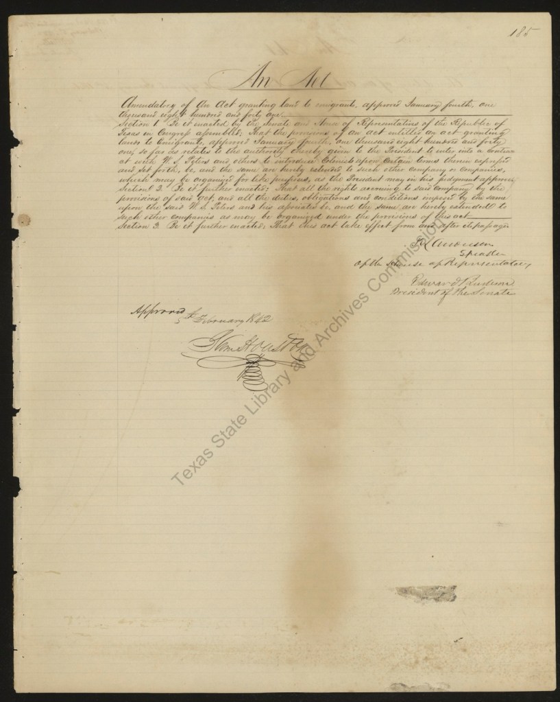
An Act Amendatory to the Several Acts and Ordinances Granting Bounty Lands
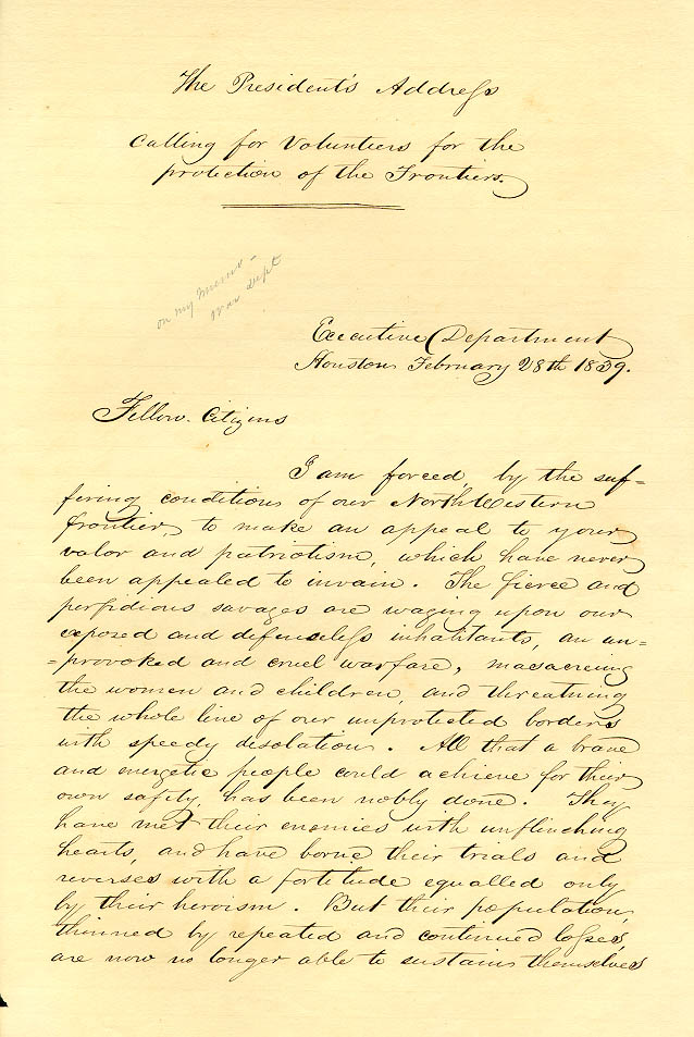
3. Elimination Declared On December 9, 1838, President Lamar told Congress that the Republic must open a war against Indigenous peoples that would “admit to no compromise, and have no termination except in their total extinction, or total expulsion.” Within twelve days he had signed the Frontier Protection Act. Within seven months, the Cherokee — settled in East Texas for fifteen years — were expelled by force.
Houston had preferred diplomacy; Lamar preferred declaration. The contrast was tactical, not structural. Both served the same territorial end.
4. Replacement Society at Scale The 1841 Act Granting Land to Emigrants launched corporate colonization — contracting with companies to import settlers from England, France, Germany, and America. The Fisher-Miller Colony (1842), sold to the German Adelsverein in 1844, encompassed what are now Kimble, Mason, Menard, and five other Hill Country counties. The archival record is explicit: its boundaries “existed deep into Comanche territory.”
The structure was indifferent to settler ethnicity. German, French, English, Anglo-American — all performed the same structural role: permanent occupation of Indigenous land.
Diplomacy as a Trap, 1836–1840
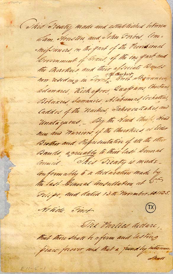
Every treaty the Republic negotiated with Indigenous nations performed recognition while delivering dispossession.
The Senate’s 1837 Standing Committee on Indian Affairs set the terms when it refused to ratify Houston’s 1836 Cherokee treaty, resolving that “no fee simple right of soil be acknowledged by this Govt in favor of these Indians.” Every subsequent treaty — the 1837 Tonkawa treaty, the 1838 Comanche treaty, the 1844 Tehuacana Creek treaty — operated within this constraint. Sovereignty was performed in form; denied in substance.
The 1838 instructions to Colonel Karnes for Comanche negotiations said it plainly: negotiate peace “without indicating the precise limits of the territory which will be secured to them.” Define nothing. Acknowledge nothing. Concede nothing that would contradict the land grants already being issued over Comanche territory.
The Council House Fight — March 19, 1840
The Secretary of War’s instructions were issued before the meeting: if the Comanche delegates failed to deliver all captives, seize them as hostages. The diplomatic invitation concealed a military trap.
On March 19, sixty-five Comanche — men, women, and children — entered San Antonio with one captive instead of many. The twelve principal chiefs were led into the Council House. Troops were positioned at the doors. When told they would be held as hostages, the chiefs drew weapons and fought. All twelve were killed. Twenty-seven women and children were captured. Thirty warriors died in the streets and surrounding buildings.
What was destroyed was not just twelve individuals. It was the political leadership of the eastern Comanche bands — the authority capable of negotiating, signing treaties, and binding the nation to agreements. This is Wolfe’s negative dimension of elimination: not the destruction of bodies alone, but of governance structures.
The Great Comanche Raid — August 1840
What followed was not savagery. It was a coordinated sovereign military response to an act of state violence.
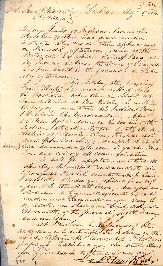
In August 1840, Buffalo Hump led five hundred to one thousand warriors from the Hill Country to the Gulf Coast — striking Victoria on August 6, burning Linnville on August 8, and returning north laden with several thousand horses and the plunder of two towns.
The Comanche who dressed in the broadcloth coats and silk hats seized from Linnville’s warehouses were not playing dress-up. They were performing sovereignty — demonstrating that the goods flowing into Texas to supply its settler population could be taken, that the paper sovereignty the Republic had been constructing since 1836 could not yet protect the physical geography it claimed.
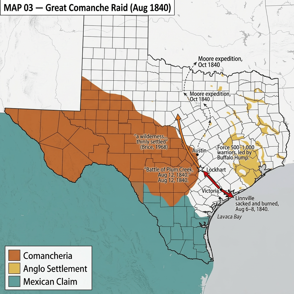
The scale of the raid also revealed how incomplete that sovereignty was. The country between the Guadalupe and Colorado rivers was, in one contemporary’s words, “a wilderness, while below that line it was thinly settled.”
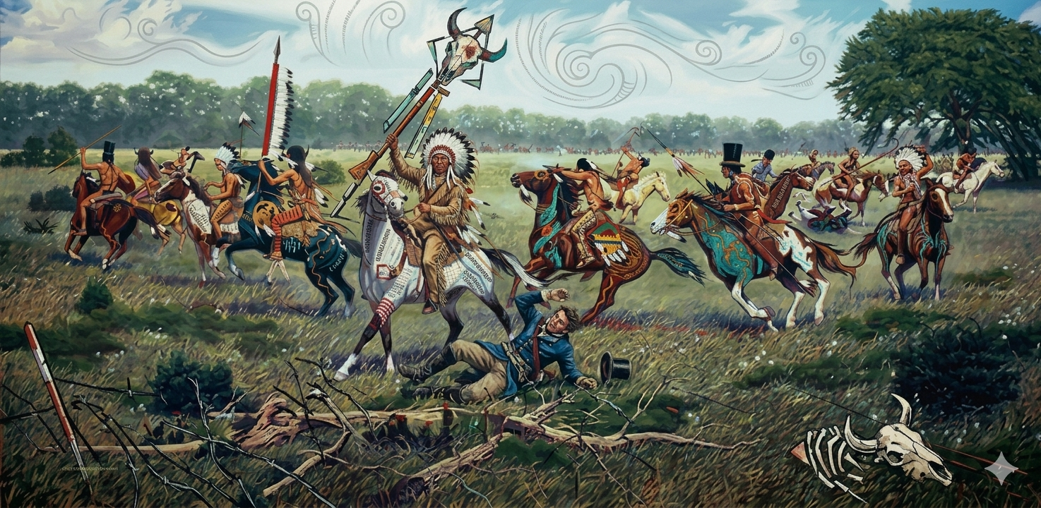
Battle of Plum Creek — August 12, 1840
The force that assembled at Good’s Crossing on Plum Creek embodied the settler-colonial structure in human form:
- Anglo-Texan volunteer settlers — whose land grants awaited them beyond the fight
- Texas Militia — the state’s formal military authority, commanding the whole
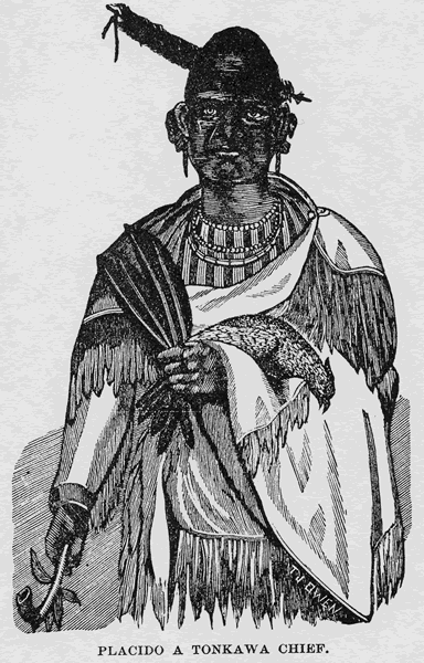
- Tonkawa warriors under Chief Placido — Indigenous allies of the Republic, wearing white rags on their arms so Texans would not shoot them
Three categories of people, in the same space, assigned differential roles by the same colonial order. Saldaña-Portillo calls this the production of colonial space: the classification of people into hierarchies, enacted on the ground.
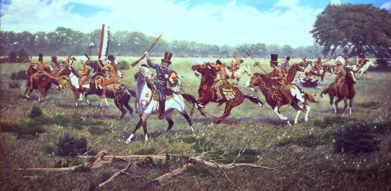
The Comanche were routed. Over eighty chiefs and warriors were killed; thousands of horses and the entire plunder of Victoria and Linnville were recovered. The Texans lost one man.
By winter, Hämäläinen writes, “most Comanches had retreated north, leaving thousands of square miles open for settlers from Texas.”
The gap between paper sovereignty and physical possession — open since 1836 — had begun, at Plum Creek, to close. This is what this exhibition calls a territorial writing act: the moment the structure’s legal claim began to become physical reality.
Noah Smithwick, who had known Chief Muguara personally, observed of the Republic’s subsequent destruction of Comanche villages: “It was but the counterpart of the Indians’ raid upon Victoria and Linnville, and yet what a different aspect it assumed when the parties changed places.” That asymmetry — same violence, different meaning — is the cultural imaginary of settler colonialism at work.
The Line That Was Never Drawn — 1844
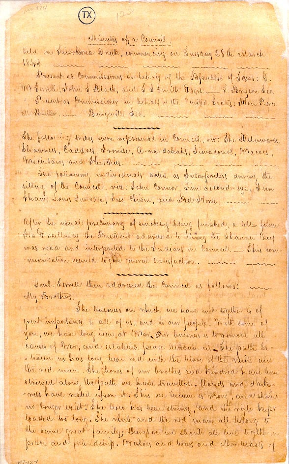
On March 21, 1844, Comanche Chief Mopechucope wrote to Sam Houston from near the head of the Colorado River. His letter is the document this exhibition was built to recover.
He specified the boundary of Comanche Country with geographic precision — from the Brazos River over the Comanche Peak, to the San Saba confluence with the Colorado, then to the Rio Grande — and declared:
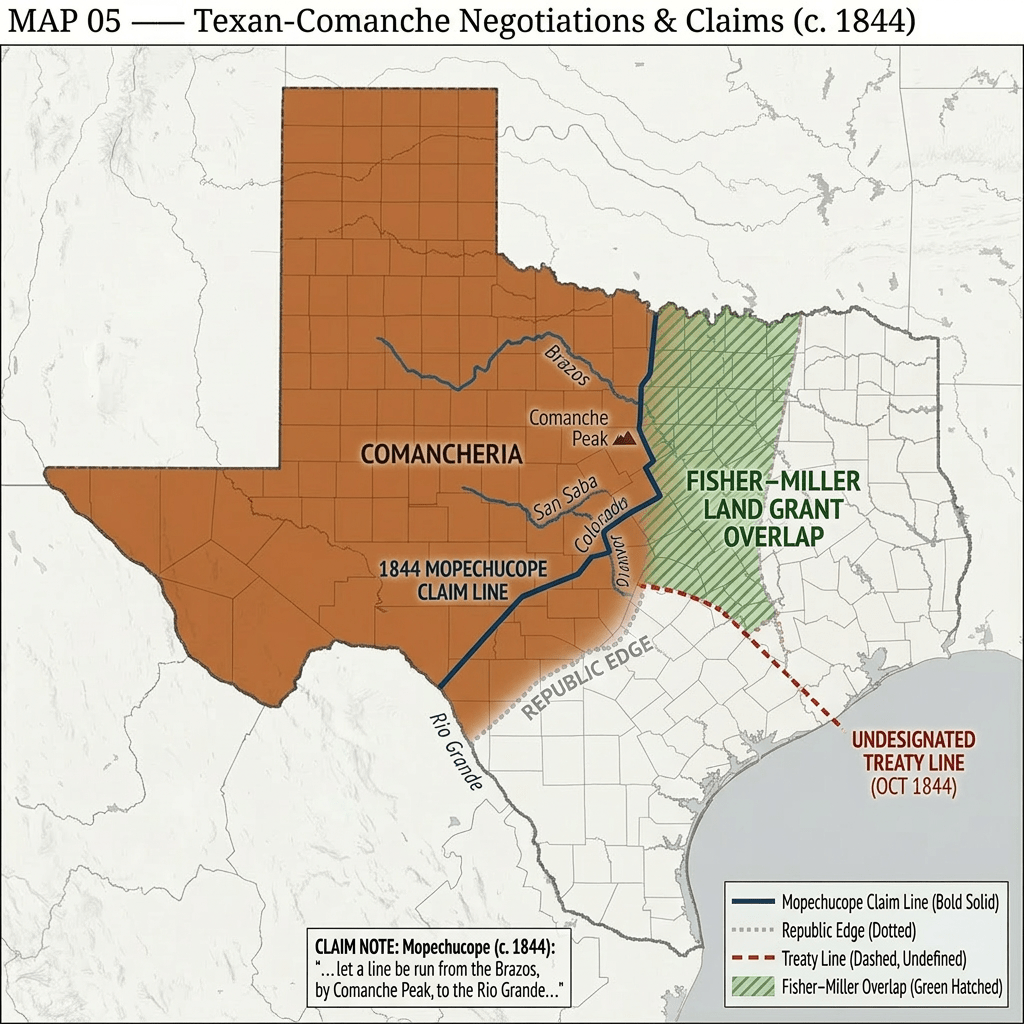
“all above that line is Comanche Country and ever has been I my self never have left it nor never intends to.”
This is not a petition. It is a diplomatic communication between heads of state — a sovereign territorial claim as specific as any treaty article the Republic ever drafted.
The Treaty of Tehuacana Creek, signed October 9, 1844, acknowledged a line. Article XII states that trading houses will be established “below the line, to be run and marked.”
The line was never run. It was never marked.
Buffalo Hump and Mopechucope signed. Both men put their marks on a document that performed sovereignty while denying it — ratifying in diplomatic form the territorial transformation that military force had already produced on the ground.
📄 [Document: Mopechucope to Houston, March 21, 1844] 📄 [Document: Treaty of Tehuacana Creek, October 9, 1844] 👤 [Profile: Mopechucope (Old Owl)] 🗺️ [Map: Mopechucope’s Boundary Claim vs. Republic Territory, 1844]
Annexation — The Structure Scales Up
Texas joined the United States on December 29, 1845. The western counties had voted for annexation, as Hämäläinen records, “largely out of hope that the U.S. Army would neutralize the Comanches and expel them from the state.”
The logic of elimination did not end. It scaled to continental dimensions. The colonization contracts continued generating patents through the 1850s. The U.S. Army built a fort line across former Comanche hunting grounds. The campaigns that would finally break Comanche power — culminating in the Red River War of 1874–1875 — were the direct continuation of the structure Lamar had set in motion in 1838.
What This History Produced — and Still Produces
Texas is a palimpsest — a landscape written over, again and again, each inscription layered on top of what came before. The county lines follow survey boundaries drawn on Comanche territory in the 1840s. Land ownership patterns reflect the differential entitlements written into the 1836 constitution. The cultural imaginary of Texas — the Alamo, the Ranger, the frontier hero — organizes what is remembered and what is suppressed in a state whose founding story is liberty and whose founding structure was elimination.
Claude Lévi-Strauss argued that myth is not simply a false story. It is a narrative that manages an irresolvable contradiction — making livable what cannot otherwise be reconciled. American exceptionalism is that myth: a political culture built on liberty and equality, erected on the systematic elimination of the peoples whose land made it possible. The myth resolves the contradiction by declaring Indigenous peoples savage — outside the moral community to which liberty applies. It reframes dispossession as destiny.
This exhibition answers the myth with evidence: Mopechucope’s letter. A sovereign leader, specifying his nation’s territory with geographic precision, asking the Republic to acknowledge what the Comanche had always known. The treaty heard his claim. The surveyors never came.
Texas is not exceptional. It is structurally legible — one instance of a pattern that operated across Australia, Palestine, southern Africa, and the Americas wherever settler societies sought to permanently replace Indigenous ones.
Understanding this is not about guilt. It is about what philosopher Michel Foucault called critical maturity: the willingness to interrogate the power structures that produced the world one inhabits — because only by understanding how something was made can we recognize that it was not inevitable, and that the future is not determined by it.
The line drawn in 1836 has never stopped being drawn. It has been redrawn in every survey, every property deed, every county boundary, every highway across former Comanche territory.
What do we owe to the full story of the ground we stand on?
