Plum Woke# Historical Maps
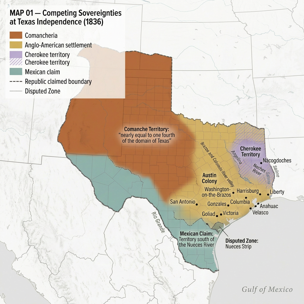
Competing Claims at Texas Independence, 1836
Multiple overlapping sovereignties define Texas at independence: limited Anglo-American settlement, expansive Comanche territory, Cherokee presence in East Texas, and Mexican claims to the south—while the Republic asserts a boundary it does not control.
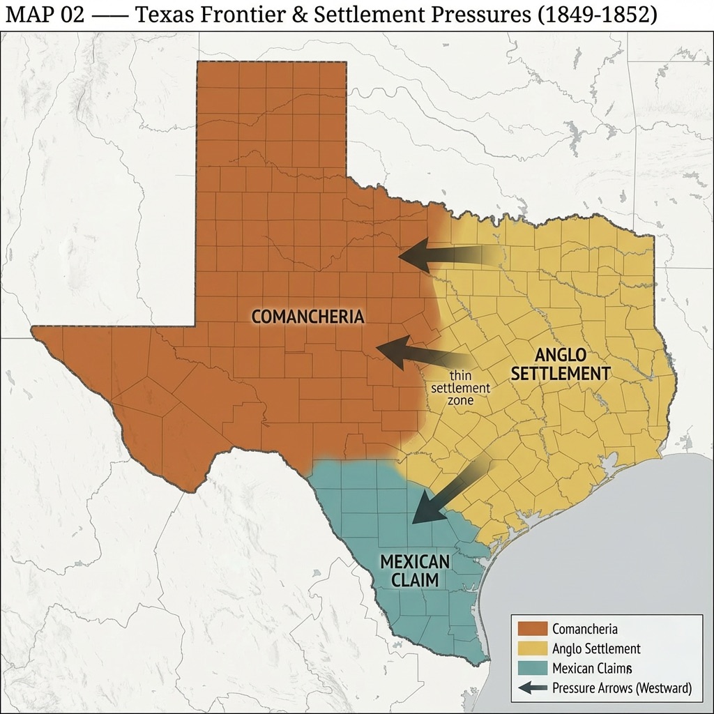
The Lamar Advance and the Frontier Line, 1838–1839
Settlement expands north and west under Lamar as a defined “frontier line” emerges; Cherokee removal and the positioning of the capital at Austin mark the consolidation of territorial assertion.
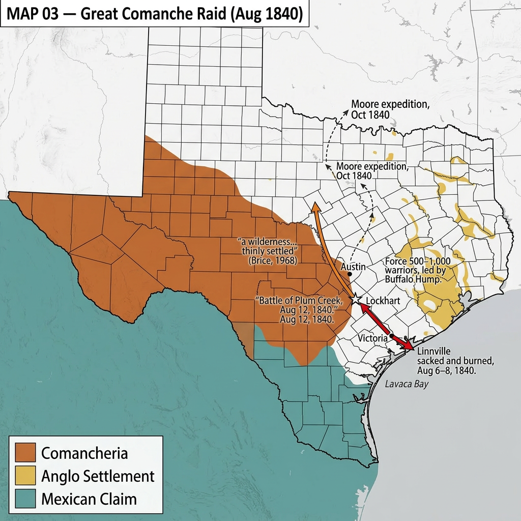
The Great Comanche Raid, August 1840
A large Comanche force moves from the Hill Country to the Gulf Coast, demonstrating sustained military reach; the return route and the Battle of Plum Creek mark the encounter with Texan forces.
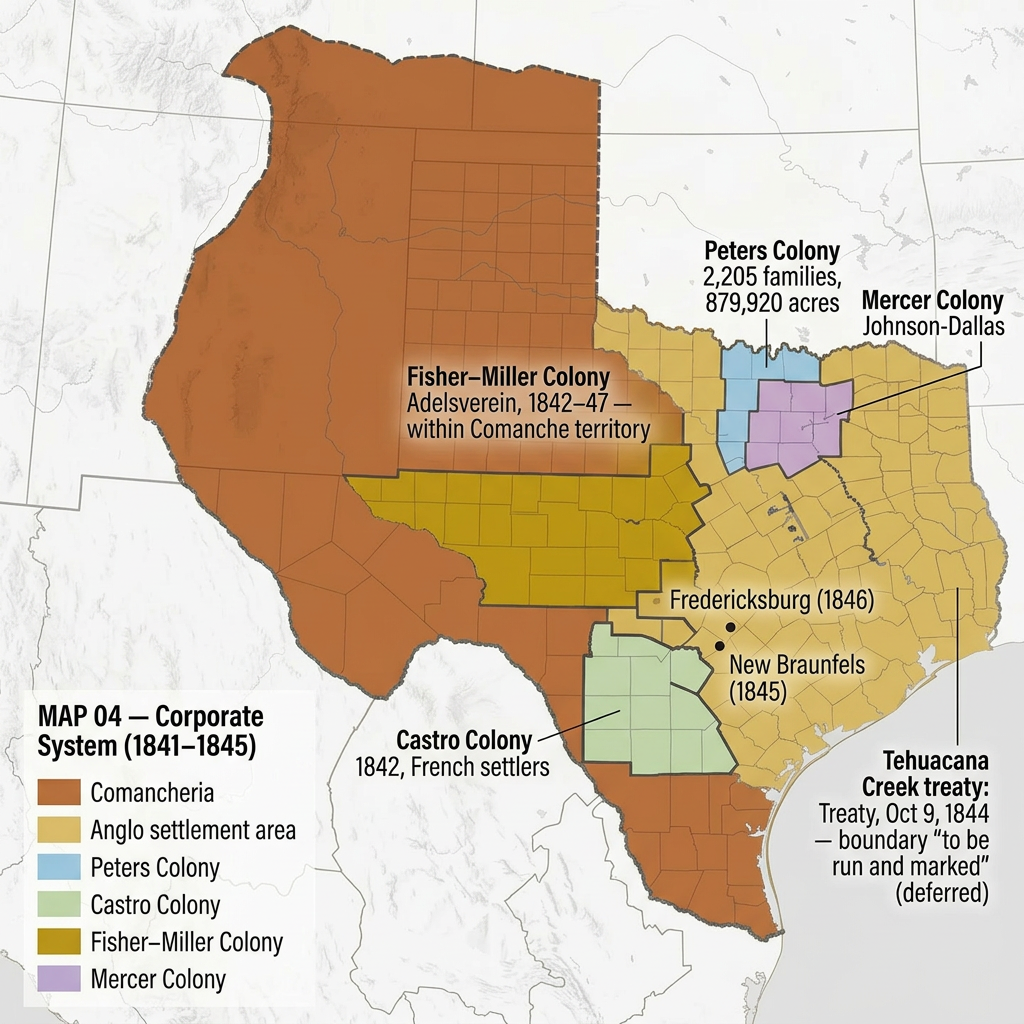
The Corporate Colonization System, 1841–1845
Large-scale land grants—Peters, Castro, Fisher-Miller, and Mercer—organize settlement across Texas, including areas within Comanche territory, linking colonization to structured expansion.
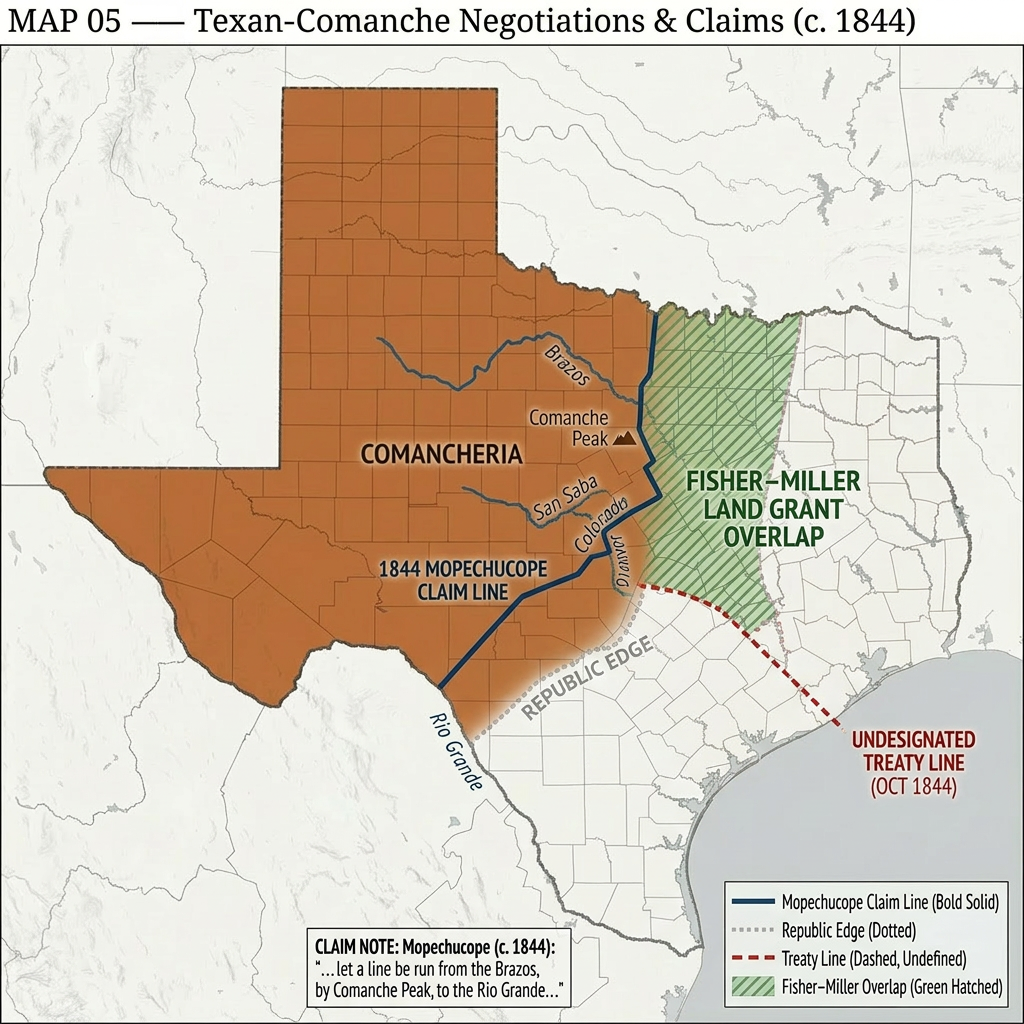
Mopechucope’s Boundary Claim vs. Republic Expansion, 1844
A defined Comanche territorial boundary contrasts with expanding settlement and grant claims, while a proposed treaty boundary remains unmarked.